Nationwide Access to the #1 Hunting App
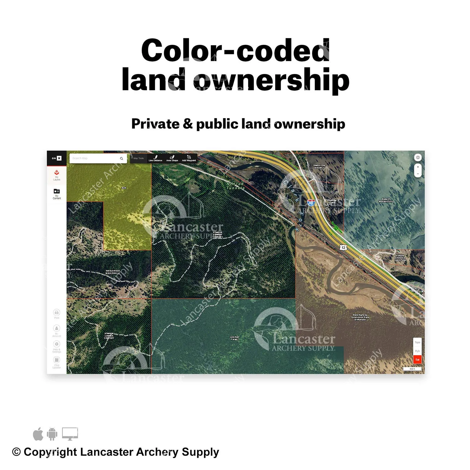
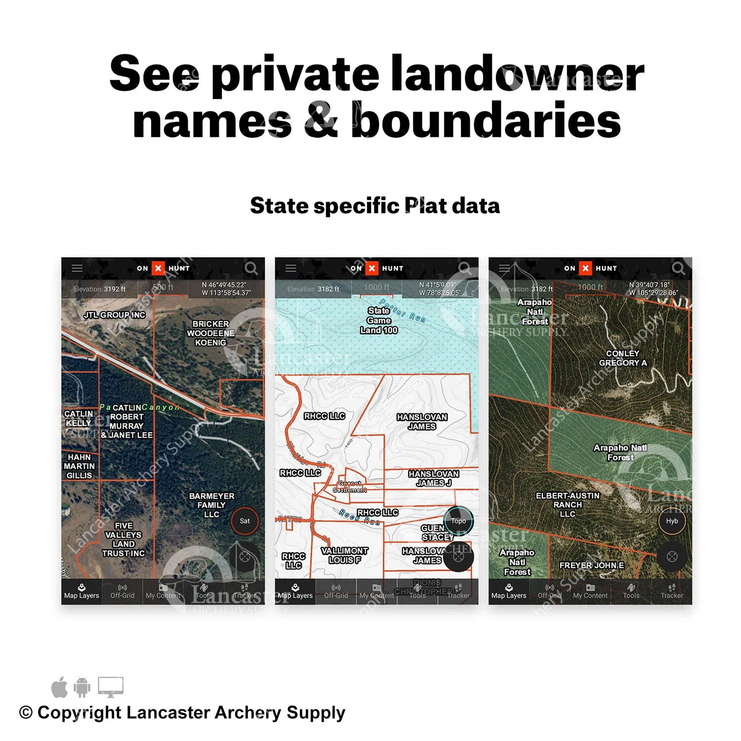
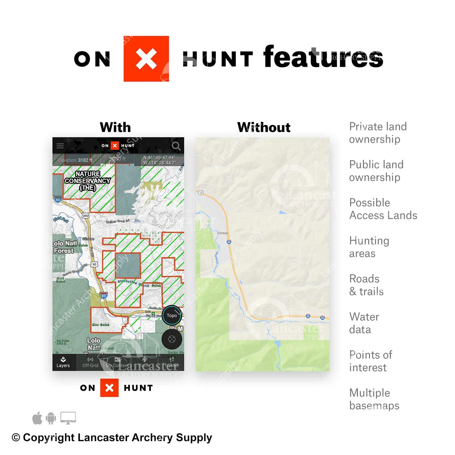
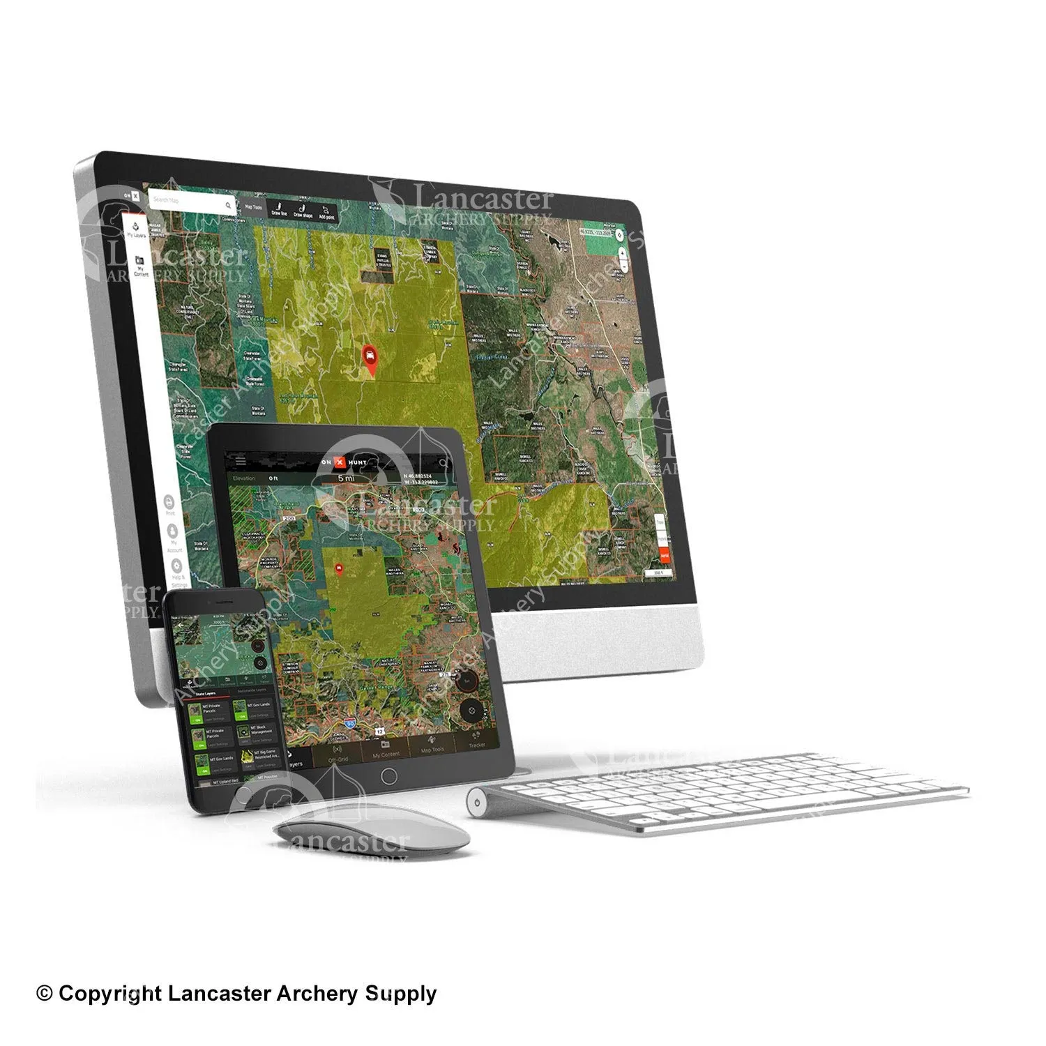
An onX Hunt Elite Membership provides detailed maps for all 50 states and Canada and includes access to onX Hunt’s proprietary Basemaps, property lines, landowner information, GPS Map Tools (Waypoints, Tracker, Line Distance, Area Shape, and more), Wind & Weather, Offline Maps for use without cell service, Sharing, and hundreds of hunt-specific layers. Put the nation’s most accurate land ownership information in the palm of your hand with onX Hunt Elite.
Elite - Exclusive Map Tools
Plan, scout, and hunt better with TerrainX, a vast array of aerial imagery options, revolutionary Trail Cam Integration, Route builder, In-Dash, and more.
Pro Deals on Trusted Gear
The folks at onX are firm believers that quality gear makes a difference. As an Elite Member, you’ll have access to exclusive pricing on products and services hand picked by the onX Hunt team. If we don’t use a product from these brands, you won’t find them here. We’re always adding more world-class companies to the list, so keep checking back.
Expert Resources and Education
Learn from the best with Elite-exclusive courses and education from the best hunters onX knows. From elk in the Rockies to southern whitetail and bird dog training, onx has you covered.
Western Application Strategy
As part of your onX Hunt Elite Membership, you receive access to three industry-leading companies—Huntin’ Fool, Toprut, and HuntReminder—for free. Use Huntin’ Fool’s on-the-ground research alongside Toprut’s precise draw odds and HuntReminder’s worry-free reminder service to help plan trips, apply by the deadline, and draw more tags for your western hunts.
Features:
- The most extensive maps out there
- Proprietary data collection and analysis power the most accurate and current maps available
- 121 million private properties, 421 map overlays and counting, 985 million acres of public land, 400,000 miles of trails
- Cross country access that can be used through multiple devices
- Can be used on desktop/laptop computers, apple/android tablets and smartphones, and also Garmin GPS devices
- Maps can be saved and accessed offline from the GPS in your mobile device (even when the network is nonexistent)
Specifications:
- Private land boundaries show property lines so you can hike with confidence
- Public land boundaries shows how far you can chase those trophy animals
- Offline maps allow for saved maps to be used offline
- Aerial imagery with 24k topo combine the power of aerial imagery with topo lines to give you the best understanding of the terrain
- National roads & trails show road names and numbers for rural backroads, forest service roads, scenic byways, decommissions and trails
- Custom way-points give you the ability to drop way-points at sign, rubs, bedding areas so you can come back to those points
- Share a way-point with your friends so they can find where you are
- Tracking allows you to track your path and follow your way back to camp or the truck
- Point of interest shows fishing access sites, beaches, campgrounds and more
- Sync Mobile and computer syncs all of your data from your phone to your computer and vice versa
- You will receive a code that you must use to create an account, enter your redemption code to enjoy the app and Hunt chip updates for a year
- Elite membership gives you full access to all 50 states for 1 year


